Monday, December 3, 2018

Walking with the Inca - A trip to Machu Picchu


"Ama suwa, ama llulla, ama qhella" – was the age-old quote in the Andean highlands that defined the code of life for a nation that rose from oblivion to become one of the greatest cultures of its time…The Inca. The Quechua saying means, “do not steal, do not lie, do not be lazy”. This simple rule that defined the social interaction within this people was enough to create a kingdom, 500 years ago, that boasts one of the seven wonders of the world today…Machu Picchu.

Coricancha - Cuso
The passage to Machu Picchu using the historic trail is very controlled – only 500 permits are allowed per day, and that includes porters and guides. In addition, you can only use the trail under a guided tour. The permits are generally booked months in advance. So, it was decided at the beginning of the year, that this is where I will venture this year. Do the Inca, take the trail and walk the same footsteps that thousands of ancients used to move between the Incan capital Cusco and the King’s summer abode of Machu Picchu.

The sacred valley
The best time to do the hike is between August and October. This is the end of winter season in the Southern Hemisphere and the dry season is at its peak. I had originally booked my trip in September but had to revise the dates to November. November is when the wet season starts in the Andean highlands; so, with crossed fingers, I packed my bags, and greased my hiking boots to start the one-week trip to Peru.
Pisaq
Cusco, the ancient Inca capital is the first stop. Close to 3000m elevation, this also acts as a stop over to get climatized to this high elevation. Cusco is also where the Peru Rail starts in train journey for Machu Picchu, for those who do not want to toil the 4-day trail. The town is full of tourists, young and old. Many rejoicing in the memory of the marvel and plenty, looking forward to witnessing it. There is plenty to see in and around Cusco and this is where you get your first acquaintance with the Incas. The city had the largest temple of the empire, dedicated to sun, moon, stars and lightening called Coricancha. The Spanish destroyed the temple structure and built a convent on its foundations, but still some sections of the Inca architecture are wonderfully preserved here. 
Sacsayhuman
Nearby, there are other Inca sites that are accessible within driving distance. One site is Sacasayhuman, which presents a classic experience to view the architectural brilliance, use of local rock formations and use of ramp and rollers to move huge granite blocks set on one another without use of mortar. Or, a trip their sacred valley agricultural hub of Pisaq; that show cases their terraces and farming techniques. The final stop before the start of the trail is at Olyantamtobe, a massive Inca fortress. This is where you can see Tambos (the living quarters) and the Quilcas (grain silos), up and close.

Now, that you have been in Cusco and nearby towns for the last two days, you are ready to embark on the 4 day Inca trail.
Starting the Inca trail

 Day 1


The trailhead starts at km 82, a half an hour drive from Olyantaytambo. Some paperwork, and a quick walk through a small museum and you are on your way. This is also where I meet my guide Oswaldo, the cook Rosario and a team of four hard working, sturdy and light footed highland porters. It is these porters that make these excursions possible. And this is where you see the wonder that is coca leaf in action. Seeing these porters chewing a bunch of coca leaves and running up and down the trail, takes you back in time when the Incas used to have runners between their fortresses and the miracle coca plant.

Willkarakay settlement
Porters make light work of the aggressive climb
The first day is a gradual 12km hike with a net gain of 300m to a final elevation of 3000m. We hike along the Urubamba river for most part before climbing up to Huallabamba for the night camp. As we are passing through the rich and fertile valley, we see a lot of native flower and Fauna, including orchids, grenadine, avocado, passion fruit and corn. You pass through several villages where the highlanders still believe in the ancient Inca religion, seeking blessings of the surrounding snowcaps, and “Pacha-Mama”, the mother earth. The amalgamation of the catholic influence is definitely there but gets very limited as you start climbing up the trail. The highlight of the day is Willkarakay, a mountain side agricultural site that is a beautiful testament to the surprises this trail holds, before delivering you to its final jewel at Machu Picchu.

Day 2:

This is by far the toughest day of the trail. Right from the beginning the trail winds upwards at staggering pace. We will climb from to 4200m at Warmiwanuska (Dead Woman) pass, before climbing down to 3600 for the night at Pacaymayo. The climb is made more difficult by the fact that the 1200m gain is completed in only 6-7km, so a good gradient. In addition, unlike many other trails, the Incas used the mountain to their advantage; and that implied using stairs rather than straight path. In total the 4 day trail has more than 20,000 stair that you climb up or down. 


Approaching dead woman' pass
As we climb up towards the mountain pass, the clouds start coming in and it starts to drizzle. The cloud cover does not allow a direct sight of the snowcapped mountains and increase the mystery surrounding the ancient valley. We reach the top in 5 hours, to be greeted by tightening valley, above the tree line and plenty of Lamas. The Urubamba is now a silver thread somewhere down below. I cannot emphasize enough to take altitude sickness seriously here. The sudden elevation gain is quite visible and can cause headaches and fatigue issues if not taken care of properly.
After a short stay at the top, we climb down the trail to Pacaymayo. The climb down was made quite treacherous by the pouring rain. This is where good hiking boots, and the use of hiking poles helps. Many a hiker slipped that day, especially when climbing down the stairs – no wonder the stones had been polished thoroughly after centuries of use.

Day 3:


Intipata terraces
This is a long day in terms of distance, 18km in total. But almost all of it is downhill apart from the first couple of hours. We climb up to the Runkurakay pass at 4000m, before climbing down all the way to WinayWayna at 2665m, right at the gateway of Machu Picchu. That night it had rained quite heavily, and it was still foggy when we started the climb up to the pass. 

Urubamba comes in sight again
My guide asked me to climb at the top a short hill at the top of the pass to an altar. He wanted to perform a ceremony, praying to the ancient gods. Testament of the local beliefs that are still entrenched despite centuries of Christian influence. Taking three coca leaves, each representing the three stages of the world – the top or the heavens represented by the might condor, the middle where Inca lived, and presented by the powerful Puma and the under, represented by the Serpent. Inca did not believe in the concept of hell, but in another birth – hence they would bury their dead in fetal positions, mummified and with their belongings, ready to start the new life. We completed the ritual and started our climb down. It is almost all stairs from now to WinayWayna, and majority of this is the actual trail. Once again, the rain had made the journey challenging, both physically and mentally. In this one day alone, we come down almost 7000 stairs.


The climb down is made interesting by passing through several ruins at Phuyupatamarca and Intipata. As the trail passes right through Intipata, it allows you to see the marvel of Inca architecture on a smaller scale, including aqueducts, water fountains and the living quarters. Intipata, place of the Sun, is also where you start seeing the Urbamba river once again and the valley opens to show its grandeur. The WinayWayna ruins are very close to the camp site. This was a farming location that was built to secure food for the city of Machu Picchu. The site starts distinguishing between upper and lower-class houses, showing that you are approaching a seat of power now and its name seems to have kept it purpose…. WinayWayna means forever young. 

Day 4:

Negotiating the Gringo Killer
Today is the day. This is where it all comes together. We get up early to meet other hikers at the final check point. Although the gates are only opened at 5:30 in the morning, there is already a crowd gathered at the gate. From here on, it is a simple 5km walk to the ruins. However, the trail holds its biggest surprise right here. Around 3km into the trail is the Inti Punku (The Sungate). This acted as the guard point to the city and is perched on top of a small hill which is accessed by climbing a near vertical and narrow flight of 53 stairs, cleverly named by the guides as “The Gringo Killer”. From this view point, on a clear day, you can see the entire city of Machu Picchu, with its terraces, the central pyramid stricture, the temples, the living quarters and the lush gardens. The city is shaped like a condor facing the Huyana Picchu mountain.


There she is!
Entering the city
When we reached the sun gate, the weather had turned cloudy and there was a number of hikers gathered there, not wanting to leave before getting this glimpse of the city from this vintage point. One by one, they all left, until it was just Oswaldo and I sitting on the Inca laid stone wall. I looked at him and said, “I need to see it – won’t be back here any time soon”. He replied very calmly, “in that case you must blow to move the clouds away”. And just like that we both blew into the wind, and for that one moment, the cloud cover parted, and we got to see the site that we had travelled all this time for. When you view the city from this vintage point, you can close your eyes and go back 500 years to imagine all the Inca pilgrims, walking in line with their children and Lamas in tow, climbing over the sungate, and setting their eyes on what must have been a bustling place at the time, with banners, and thatched roofs, and chants of religious ceremonies, and music.

The Condor temple
The immaculate walls of the King's Chamber
Taking it all in, we start the short climb down to the city. Pictures cannot do justice to the architectural marvel. As you walk through the main entrance, you are welcomes by terraces, and two storied huts, and barns, and grain storage sites and the king’s chambers and the central structure of the sun temple, and the cleverly carved condor temple – all leading up to the Sun Dial on top of the central pyramid. When Bingham discovered this place in the early twentieth century, he wrote that he was mesmerized by the fineness of some of the walls. You can witness the excellence, when you visit the king’s chambers or the temples, where stone after stone has been immaculately placed, just like Lego blocks, finished to a razor edge straightness and knit without the use or mortar. It took us good three hours to visit all the main sections of the city.


Machu Picchu
Finally embraced by the joyful feeling of been there, done that…. we take the bus back to the city of Aguas Calientes, for a well-deserved lunch, and onward to Cusco using the Peru Rail. As the train rushes through the corn fields, in the shadows of the snow caps and amidst the sounds of the Urubamba river; I cannot help but send a silent prayer to Pacha-Mama for letting me see her wonders. And then, I calmly sit back, close my eyes, and chew on my coca leaves.


Take it all in, in just 5 minutes at....


Saturday, October 14, 2017

Climbing to Africa's Roof - A trip to Kilemenjaro

A Nomad’s Diary: Climbing to the top of Africa

I am sure if you have a free spirit residing somewhere deep in your heart, you must be carrying with you a list of “to do” things. For me, this list sort of evolved over the last few years. I had to relocate to Canada for work and that is where I discovered my love for a camera and the heavenly scenery around me. The quest to find that next best shot or the view from the top, led to hiking. The feeling that you get when you go around that rock outcropping and the lookout opens to a vast valley leading to snowcapped mountains – or the clouds swirling below – or that first look at sun as you sit on the top of your trail waiting for it to happen…the rush cannot be told, it can just be felt. My “been dere, done dat” list started changing. The sky scrapers moved aside and Machu Pechu, K2 Base Camp, Gondora La, Kilimanjaro and Denali creeped in. Having done the K2 trail last year, the coin was flipped and the call for 2017 came for Africa, Kilimanjaro, the tallest free-standing mountain in the world and Africa’s highest point.

In September this year, I booked myself in for the 6 day Machame route to the top of the Kilimanjaro. The usual speech for any such adventure is a must here as well. Know your group, know your guide, know your route, know your climate, know your limit and above all, plan for it.

I met my group Saturday morning – Scott, Mike, Will and Colin. Two brothers, a brother in law and a high school friend. Our guides and porters welcome us by saying “Jumbo” or hello in Swahili. And we immediately hit the right spots. We compared our notes, who has done what before, who has what kind of medicines, who has “Diamox” the altitude sickness medicine, who has the pain killers, who hikes fast, who hikes slow…and above all, who loves to play which card game. Our guide Minja, preferred to be called Mr. Goodluck or Mr. 100% - while our Assistant Guide preferred to be called “God bless”. We need all three – so we were fine with the names!

Day1 : The first day of the hike is an easy paced one. You spend almost the same time travelling from Arusha to Machame Gate and registering yourself as you spend on the trail. There are many routes you can take to reach the peak; Machame is the most popular. Primarily because of the impressive views, varied habitats and shorter duration. At the same time, it is also known as Whiskey route, given its reputation for the tough climb. In contrast to Marangu route, which is nick named Coca Cola route for its ease and the capacity to sleep in huts, than tents. So day 1 starts at the Machame gate which is at 1,640m elevation. After registration, you start a gentle climb through the lush and fertile rain forest canopy. In about four hours, including a stop for a quick snack or two, you reach Machame Camp which is around 2,850m. It is a 11 km hike, and is a good appetizer for the days to come.

Hiking through the rain forest
Day2: Today we hike to Shira Camp. Shira is a plateau around 3800m high. It is a short hike around 5km with a 1000m elevation gain.

Hiking to Shira Plateau
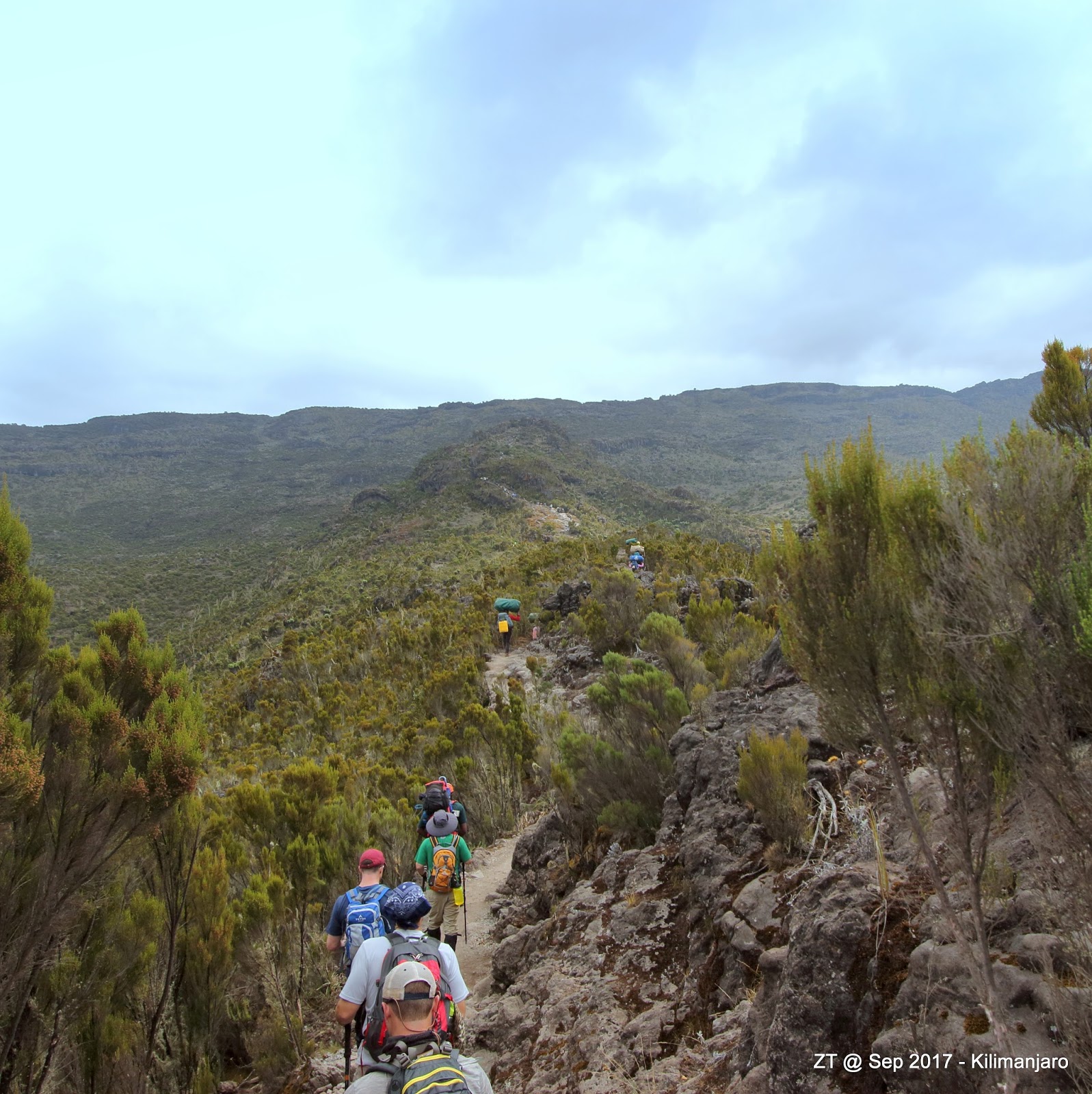
The terrain changes from rain forest to Moorland. If you are lucky, as we were, you may be walking in clouds for some part of the hike giving the Moorlands a magical exposure. Also, the habitat gives rise to some peculiar plant species that are only found here.

The "Frat Boys" and I

These are giants of their kind, seeping the moisture from the atmosphere and creating the oasis in an otherwise barren landscape. Shira camp is also a good place to get some nice sky views in the night.

The night sky over Shira Plateau

 Day 3: Today you get your first exposure to be above 4000m. The day trip is used as a acclimatization routine. We start at the Shira plateau and then keep climbing up gradually through a gentle slope to a maximum elevation of 4800m at the lava tower.

At Lava Tower
From now on, the Kibo peak is always in your sight. The lava tower is a single piece of rock jutting out at the top of the climb. It is also called “The Shark’s tooth”.

Walking through Moorlands
We only stay there for a short lunch. After the tower, we continue to climb down to the Baranco Hut camp site.

Hiking through the misty landscape

You end the day almost at the same elevation as where you started but the climb to the tower is an important step to climatize yourself and be prepared for the summit night. From my experience, this marked the end of “non-technical” hiking. From tomorrow we will start climbing, a bit of scrambling and start the 36 hours journey which will take us to the top of Africa and back.

Day4: The Baranco camp is right in the shadow of the mountain. The morning started with a beautiful sunrise over the peak. The porters celebrate the start of the day with “Jumbo Bwana” – a nice combination of lyrics with its origins in Kenya. And those of us who have seen The Lion King multiple times can clearly recognize “Hakuna Matata” which means No Problem in Swahili.

Managing Baranco Wall
After breakfast, we leave the camp and head towards the steep ridge of Baranco wall. It is amazing to see the porters carrying up to 15kgs on their shoulders and heads passing by at a running pace while you scramble on your hands and knees to climb up a few narrow ledges. Soon you are on top of the wall and the scenery opens. At this elevation, the environment is reducing to a desert. No vegetation in site. We walk towards the Karanga Camp. We see Karanga from the top of the ridge and it looks just a few hundred yards away. Until you realize that there is a steep valley between you and the camp. We had our first hail storm on way to Karanga – but it was short lived.

Reaching Barafu Hut

Finally we reach the Barafu Hut. Our destination for the evening before we start our bid for the summit. The camp is at 4600m and here we get into our tents for a few hours of rest while seeing the Mwenzi and Kibo peaks.

Day 5: This day starts at midnight. The next 24 hours were my toughest experience to date. Tonight we start our bid to climb to a final elevation of 5895m. The ascent will test your nerves. Our target is to reach Stella Point on the edge of the crater rim in time for the sun rise. We wake up at midnight and start our hike at 1 in the morning. The freezing temperature, the dark night, the limited vision that only lights up the circle of your head lamp and the sharp gain of elevation; 1300m over 5kms and 5 hrs - all play tricks. This is a “mind over body” game. Within the first hour the trail starts taking its toll. The light headedness is known to cause black outs and headaches. The trick is to stay focused, one step at a time. Your pace is low, but it needs to be consistent so you can keep your body warm. The more you stop, the more you must get yourself back in the mood. Our guide wanted us to stop after 70-90 minutes and that too for a maximum of five minutes. One of our team members drifted in a mindless walk twice and he was placed at the head of the group. Slowly but surely, we kept climbing.

At Stella Point


Along the way, we saw 7 or 8 other groups. Almost every one of them had one or two climbers who had his or her head in hands, or was feeling highly nauseated. Altitude sickness is a real concern on the summit, and this is where we all recognized the important of taking Diamox. We reached Stella point just before sunrise.

Sun rises in Africa


We stopped for 15 minutes to take it all in. Completely exhausted and drained. This is where it “dawned” on us, that we were the first in Africa to feel the sun’s rays on our faces today. When you realize that, the struggle, the mental toughness and the fatigue completely makes sense. The dawn is beautiful. Behind us, the crater comes into view, cradled by Rebmann and Retzel glaciers.

Rebmann Glacier
From here, there is an hour’s gradual ascent to Uhuru peak which is the highest point on the crater rim and the peak of Kilimanjaro.


Almost there
We were the second group to reach the peak. I still feel goose bumps remembering those final steps. I touched the sign at the top of the peak to make sure that I had been there and done that, and may to assure myself that this was not a dream.

Been Dere Done Dat

We are not allowed to spend more than 15-20 minutes on the peak to avoid altitude sickness.

A final look at the crater
The climb down the scree is aggressive. You must go down the same way as you came up, 1400m in 5 kms. And the terrain is loose rocks and scree.

All in a day's work in Africa
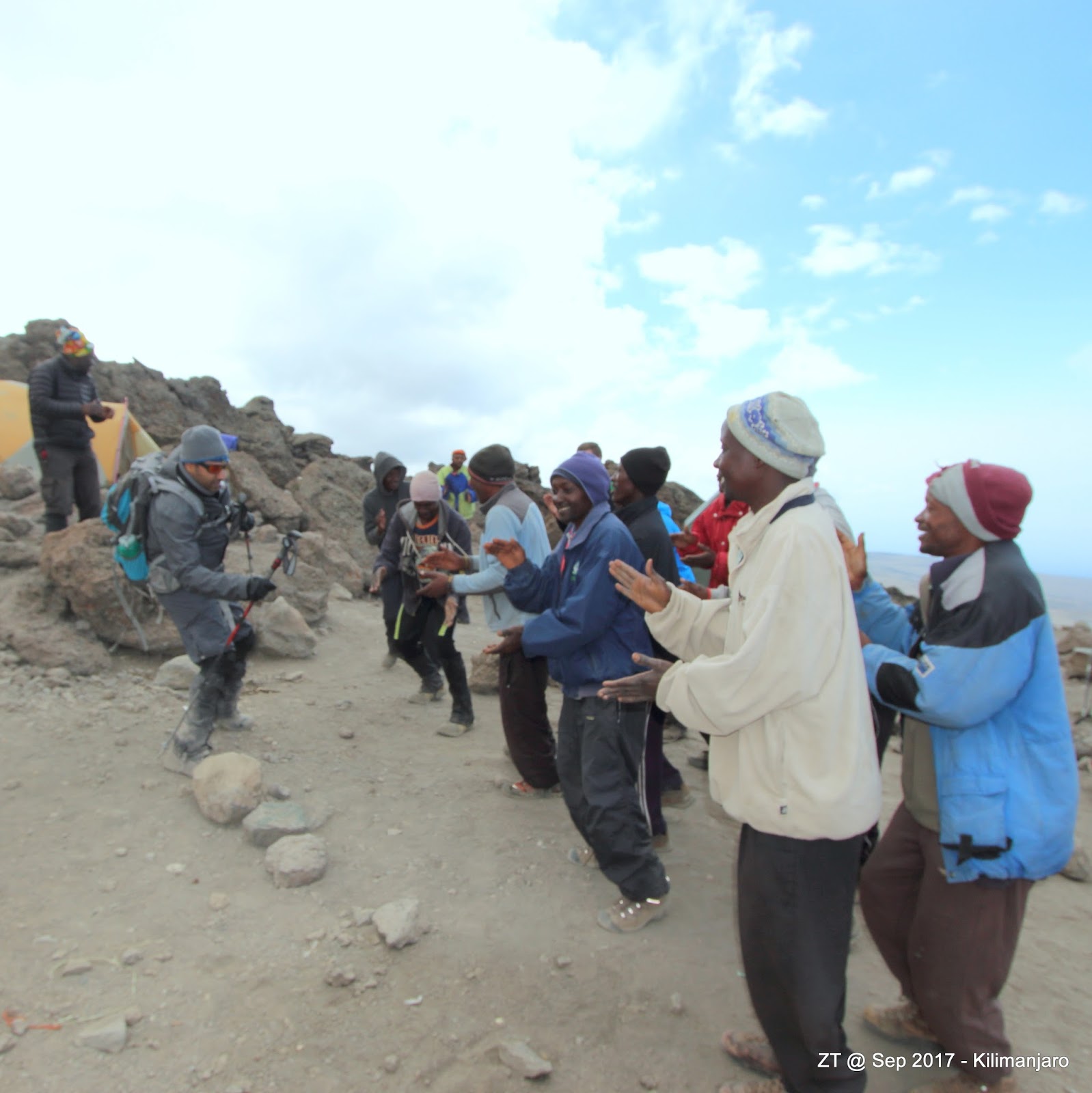
Ascent was purely a mind game, but coming down at this speed and slop, is a physical challenge. We stop at Barafu Hut to remove our layers, and have a small breather. The porters welcome every member of our team with fist bumps and songs.

Trying to match the song and dance routine
The hike down from Barafu to Mweka Hut is mentioned “easy” in most of the brochures. I think that should be revised. The trail is a stair case for almost 6kms where you climb down foot high steps all along the way. Tonight, is our last night on the trail and the crews help us celebrate it with a well-deserved cake.

The stair case down to Muweka Camp
Day 6: Finally, the last day of the trail. We spent most of the night sharing notes, sharing the stories of hallucination, black outs and drunk walking that some of us had experience on the climb. The target was achieved and now it is just a gentle stroll back to Mweka Gate for our ride to Arusha. The day starts with a final song and dance routine by our porters and guides. We take group photos and head down. At the gate, we receive our official certificates – a document to cherish. And this is where we thank our guides and porters for without them none of this would have been possible. We helped our guide to keep his luck and score intact, he came with a reputation of 100% and he maintained that with us.

The last stop

Africa lived up to its reputation. Mystic, mysterious and enchanting. We were welcomed by chants of Jumbo when we started our trip, and we end it by saying “Asante Sana” – thank you very much to one and all. Asante Sana and Kwahiri…goodbye!

From Jumbo to Kwahiri - one pack, one team


PS: You may witness it all in real time at:Kilemenjaro and back in 12 mins

Monday, August 22, 2016

Standing in the shadows of Chigori


I am sure if you have a free spirit residing somewhere deep in your heart, you will also be carrying a list in the back of your mind. You may call it “things to do before I die”, or “10 ways to live a life”, or simply as I call mine – “Been Dere Done Dat – checklist”. Around 9 years ago, I had to relocate to Canada for work. That is where I discovered a camera, and with the abundance of heavenly scenery around, I fell in love with landscape photography. That led to hiking and trekking to get the views. The feeling that you get when you go around that rock outcropping and the lookout opens to a vast valley leading to snowcapped mountains; is unspeakable. It cannot be told, it can only be felt. Having lived in Lahore for majority of my adult life, mountains were not something that I was used to, but soon I fell in love with the effort to hike to the top of the next peak, the next waterfall and the next glacier. My “been dere done dat” list started changing. The sky scrapers and the Eiffel tower, moved aside and the Machu Pichu and Kilimanjaro moved in. And then there was that one item on top of the list “Be in the shadows of Chigori – do the Concordia K2 base camp trail”

And this year, in July, a friend and I along with a 13 year old Dutch kid and his father, got this chance and we boarded our flight from Islamabad to Skardu. This is a diary of our journey and the multitude of emotions that marked it.

Usually the journey to K2 base camp is planned to span over 21 days. We had a firm stop that only allowed us 11 days. So with a lot of excitement, an understanding of the challenges that faced us, and anxiety, we landed in Skardu. It seemed like Mother Nature was not going to be kind with us from the get go. First, our 13 year old Dutch friend left his passport in the plane and we had to wait for the staff to bring it around to get his registration completed. However during that wait time, he made a number of friends, from the security guard at the door, to the ladies at the registration counter. It was very comforting for me, as a Pakistani to see the ease with which he and his father were able to communicate and the support they were being provided. In the aftermath of the deadly incident at Nanga Parbat base camp, few years back, the expedition count in the Northern Areas had dropped sharply. The welcoming attitude that we witnessed at the airport, was not limited to that building as we found out over the next 11 days. Then, we had to wait for hours at a hotel waiting for foreigner clearance that is issued by local authorities. This being a Saturday, was not making things easy. Here, once again, we got the support and very close to the deadline set for our road trip to Askole, the last road accessible village on the trail; we got the clearance.
That day (Day 1) we drove from Askole to Dasu,
Starting our journey to Askole
breaking our journey for the night. There had been a landslide and the road had to be walked across and we decided to do that the next morning.
Crossing the landslide
My memory of that journey ranges from the beautiful Shigar desert, to the flood water crossing by our seasoned driver; to the innocent and charming smiles of young children playing on the roof tops surrounded by dried apricots.
Crossing flood plains of Shigar
What impressed me the most was the cleanliness of the small village streets, and the abundance of schools….practically one seemed to spring up every mile or so, all the way to Askole. I had heard about the level of education in Gilgit Baltistan, and this was my first hand introduction to a proud, hardworking and content group of people. We had not made any reservations at the hotel that we stayed over for the night – yet, the staff prepared a larger tent for the four of us, cooked us dinner and breakfast and made sure we were comfortable. This is the essence of hospitality that seems to be at the heart of these people.
Passing through hospitable villages

Day 2– and we wake up early. Lots to catch up on. We had to make up the lost time from yesterday and trek almost 19kms to our first camping stop in Jhulla.
Approaching Askole
The walk was mostly along the riverbed, but still exhausting and set the pace for what is to come. Especially the last few kms where you can see the camp on the other side of the river and still the crossing point does not show up.
Indus tributaries
Askole is around 3000m and our goal was to reach K2 Base Camp which is at 5200m. Altitude sickness is common on these treks. Preparation for these excursions are important and that includes carrying altitude sickness medicine along the way, drink plenty of water and hike at your own comfortable pace. This first day of our trek, we met many groups of foreigners including Hungarians, Polish, Thai, Chinese, Japanese and British trekkers.
Crossing the hanging bridge over raging rivers
They were all being managed by local groups, expert guides and hardworking porters and they all felt absolutely comfortable in their surroundings.

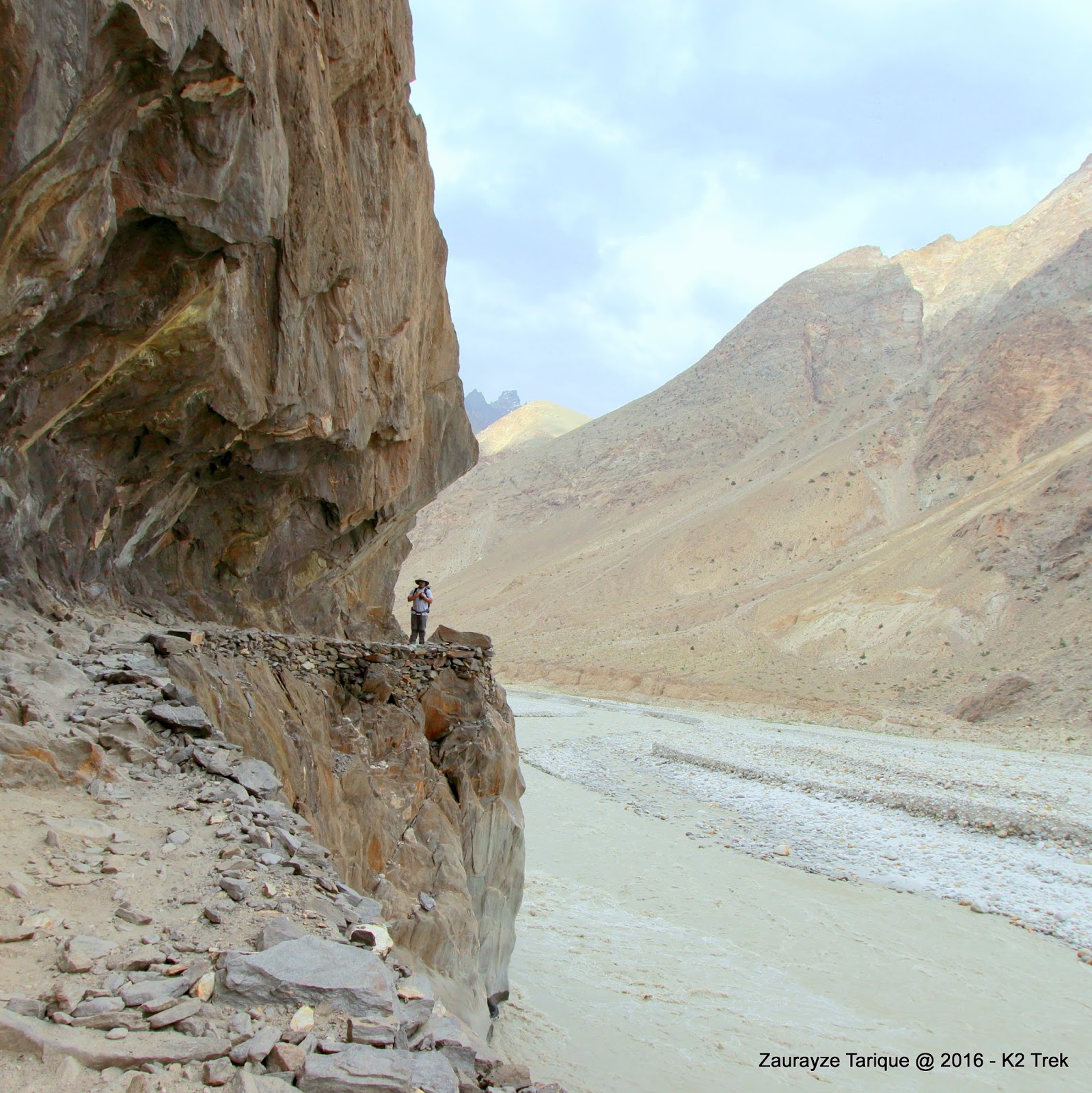
Day 3 – We hike around 22km to Payo. Once again the trek is mostly at the river level but we start climbing towards the end of the trail and the trek cut in the mountains looks beautiful.
Heading to Jhulla
On the way I meet Mr Hasan Sadpara, one of the few Pakistanis who have managed to conquer all the 8000m peaks. He had a group of foreigners with him, who were returning from K2 and GII base camps. It also included a lady from Lahore who had been inspired by Samina Baig. Very heartening to see that this trail had been made so safe that our womenfolk could come over and attempt to be with the giant peaks. We were all by ourselves at Jhulla, but at Payo we met a number of other groups. The largest being a group of Japanese trekkers, majority of them above 60 years of age, all going to Concordia. Usually, one would take a rest day at Payo; not us, we had to continue on tomorrow – starting to cross the Baltoro Glacier for what is most probably the most difficult section of the trail.
Some of the best tea ever...Payo

Day 4 – We climb up above 3500m today, and it came with fatigue, lots of it and a fair bit of pain. Baltoro at this altitude is dusty, full of boulders and rubble and hosts plenty of flies. The path to cross it is not a straight ride. You go up 20m and down 15, and you keep doing this over and over again for three to four hours.
Payo is the only green patch in this picture
At this altitude the breathing starts to come in gasps as well, so you stop every now and then to catch up. The hard work, however, starts to pay off when we near the camp site and see the famous Trango towers, a chain of mountain, practically 10kms or less from the Chinese border aligned along the glacial route, as if the guarding sentinels to the valley of giants that lays just ahead.
After crossing the rubble, dust and flies that is Baltoro
From Khurbushe onwards, the military camps start getting closer to expedition camp sites. Our soldiers provide the sense of security, all along this valley, all the way up to Siddal and Ali Camps. And when it all freezes over, they still stay vigilant – guarding our borders that stretch here, leading to China on one side, and Siachen on the other.


Day 5 – It is Eid today. The feeling sets in right from the sunrise. One gets caught out here in a nostalgic sense of being. Living miserly out of a tent and a sleeping bag, seems too easy, too good to be true. Yet, the longing to be amongst your loved ones on Eid is overwhelming at the same time. Today, we will be trekking from Khurbushe to Urdukas.
On route to Urdukas
The trek is still on the Baltoro glacier, but at this elevation the glacier is more solid, and easier to walk on. The crests and troughs seem to be urther apart, making the climb easier. Of course at this elevation you need more oxygen for every step that you climb, so that gasping for breath frequency changes from every 200 yards to every 100 yards. We get our first sneak peak of GIV and Broad peak today.
Urdukas is the green oasis on the right
The evening is made splendid by our porters and guides, gathering on a rock top, singing and dancing to the beat of an empty Kerosene Oil Canister. An Army man proudly wearing the SSG Tshirt and dancing in the middle.
Celebrating Eid at 4600m
The music in this part of the world seems to have stopped in the 70s, and the porters sing all of the songs with the same beat. It is hypnotic, it is marvelous and the time stops….Eid Mubarak. It starts getting cold in the night, and we have to keep our layers on inside the sleeping bag. It rained the whole night but the morning sun the next day was bright and shiny.

Day 6 – Now we start to truly enter the valley of the giants.
The glacier starts looking like a glacier
Our next stop Goro II. We see the ice below our feet as we walk now. Glaciers are visible now, their white snow cones and the crystal blue waterways.
The snow cones
We start coming across deep crevasses and the landscape below our feet seems to be alive, shifting and cracking. This is going to be our coldest night. The tents are pegged right on top of the icy glacier and there is one inch of mattress between you and the cold floor below.
Approaching Goro II
This is where we also say goodbye to portable toilets. While the Karakoram Valley is a declared park managed by a park authority;
Visible in papers only
this facility of toilets for example is something that needs to be improved at these camp sites. It was cold, but the skies were absolutely clear, giving us an unhindered view of a night full of stars, and a beautiful milky way.
A humbling experience
There are few other experiences that can be as humbling as standing on the door step of 8000m mountains, under a sky full of stars, and you realize the greatness of The Creator and the smallness of us as humans. That is enough to bring humility to your heart and a sense of gratitude like never before.
A porter's headlamp mocked by the glorious stars

Day 7 – We wait for sun to rise behind Broad Peak. Today we get to see her, today we will reach Concordia at 4600m and have our first look at world’s K2, our Chigori. We trek for 5-6 hours today from Goro II to Concordia, and Chigori, like a shy maiden is not visible till you have actually reached the campsite.
Approaching the valley of the Giants
The excitement edges you on, the adrenaline hangs in there. Every step brings in a new, more beautiful view of this wonderland. From ice cones, to snowcapped Mashabrum, to the giant hunch back of broad peak.
The last of the Trangos
There are gems to treasure and store in your memory on every step. We see the Mitr peak, the half-moon crest of its peak distinct against the clear blue sky. We will be resting in its shadows tonight. Finally K2 appears in sight, a single mountain on its own, and the true leader of the pack – proud and partially covered in a halo of cloud.
K2 - you just sit and watch, and watch, and watch
Tomorrow we will do the last 10 km trek, to reach an altitude of 5200m and get up, close and personal.


Day 8 – Nature is favoring us today – it is bright and sunny as we start out towards K2. Concordia is named as such because it serves as a junction, with the passage from Urdukas reaching here, only to be split in two directions. Onwards to Goodwin Austin glacier to access Broad Peak and K2, or the other way to Gondora La and Snowdome and a route into the Gashabrum Mountain peaks. We walk towards K2, keeping Mitr Peak at our back and Broad Peak to our right.
From Concordia to K2 Base Camp

We reach the broad peak base camp first, and stop for a cup of tea. We witness one of the High Altitude Porters or HAP up on the peak moving from Camp 1 to Camp 2. These porters are the invisible heroes for any expedition and sadly go unnoticed. In Nepal similar "Sherpas” are taken much better care of, with unions, benefits and training; and this needs to be improved. Chigori finally lifts her veil and we get a full and unhindered view of the peak.
Chigori lifts her veil

An hour later, we reach the K2 base camp. Three of my team members decide to visit the campsite while I move on to visit the Gilki Memorial on the Angel Mountain, which is a collection of memorable items belonging to climbers who lost their lives on these peaks; some buried right there at Gilki.
K2 base camp
I wanted to pay homage to these brave men and women, who loved the mountains, and many of whose remains are left behind in the very arms of the slopes that they so loved.
Walking in the shadows of Chigori
It is an extremely emotional experience for me, and I am sure will be for anyone who loves the mountain. The memorial items include chocolates, shoes, ropes, cigarettes and family photos taken from the personal possession of the climbers and left on the site. There are also plaques in memory of these climbers, including some Pakistani porters.
Many of the memorial plates at Gilki Memorial
The message on one of them summarizes it all, paharon ki bulandi say, baraf ki sufaidi say, ziadah behtar hai hum donon ka saath rehna. Kia aap ab bhi aisa sochtay hain? Jo pagal aap ka intezaar kar rahi hai - pagal kiko”.
Jo pagal aap ka intezaar kar rahi hai....
Humbled and honored, standing in the shadows of Chigori, I silently say to myself, “been dere, done dat” and start climbing back to Concordia.
The glacier lives and crevasses run deep

Day 9-11 (Day 9) – The weather came in on Concordia the next morning, with heavy snowfall and a white out. We started our journey back. This was going to be an ambitious three days, with almost 35kms to hike every day and our intention to be in Skardu, the third night. We will have to skip camp stops to make it happen. This would also include climbing down Baltoro, and our fatigued bodies would face the glacier much differently than before. The nostalgia kicks in immediately after Concordia. I turn back every few kms to take one more glimpse of the giants, one more look at the Mitr, one more peak at the broad peak and one more feel of the crunching ice beneath my feet. It is 10-12 hours of hiking every day. We stop overnight at Urdukas and Skimbushak.
Sun rises on our way back
We also rented a couple of horses on the way back to see the trail from a different perspective. Mine was named Raju, and did become a gentleman when crossing those narrow paths over Baltoro or when taking us along the river banks. We realized soon enough though that it was faster and steadier to trust our own two feet.
Saying farewell to the giants

While crossing down the Khurbushe glacier, I lost my way a bit and decided to follow a seasoned, older aged porter. The wise man guided me through the new crevasses and slopes down the glacier. The same day we had helped a Korean national down from Urdukas as he was suffering from severe altitude sickness. (Day 10) On our ride from Askole to Skardu, we once again had to stop at the military camp in Dasu. It was there that we were informed, that Hussein, the old porter who had so wisely and selflessly offered to help me down the glacier, had decided to help the Korean down to Askole the next day as well. This would be his last. He fell victim to a land slide just off Payo and died on the spot. This puts into perspective the hard lives of the porters and sums up how lives and stories converge in a land where mutual reliance is the key to survival. May his soul rest in peace. It is these guides, and porters that make these expeditions and summits possible. In many cases these young and old men work seasonally with the expeditions and in winters reach out to warmer climates in search of work.
Been Dere Done Dat - Thankyou
Some of the most positive and content minded individuals I have met in my life. We reached Skardu the night of Day 11 and our journey ended in Islamabad the next day.

The people of these lands welcome you with open arms, the snowcapped mountains look forward to hosting you, the apricots are being dried to be presented, the glaciers are melting slowly to let you visit them – and Chigori is ready to lift her veil….what are you waiting for?
(K2 & Back - In 15 Minutes...)